Weather Update at 11:35pm Friday 23rd
According to the National Weather Service in Ft Worth, more heavy rain is possible during the early evening hours tonight; especially near and northwest of a Comanche to D/FW to Paris line.
This may result in continued flooding of low-lying and poor drainage areas, as well as creeks, streams, and rivers. Thunderstorms will be possible during the pre-dawn hours and a few of these thunderstorms could be severe with large hail. The most likely area for severe thunderstorms will be near and northwest of a Comanche to D/FW to Gainesville line. Areas of fog will develop during the overnight hours across parts of the area.
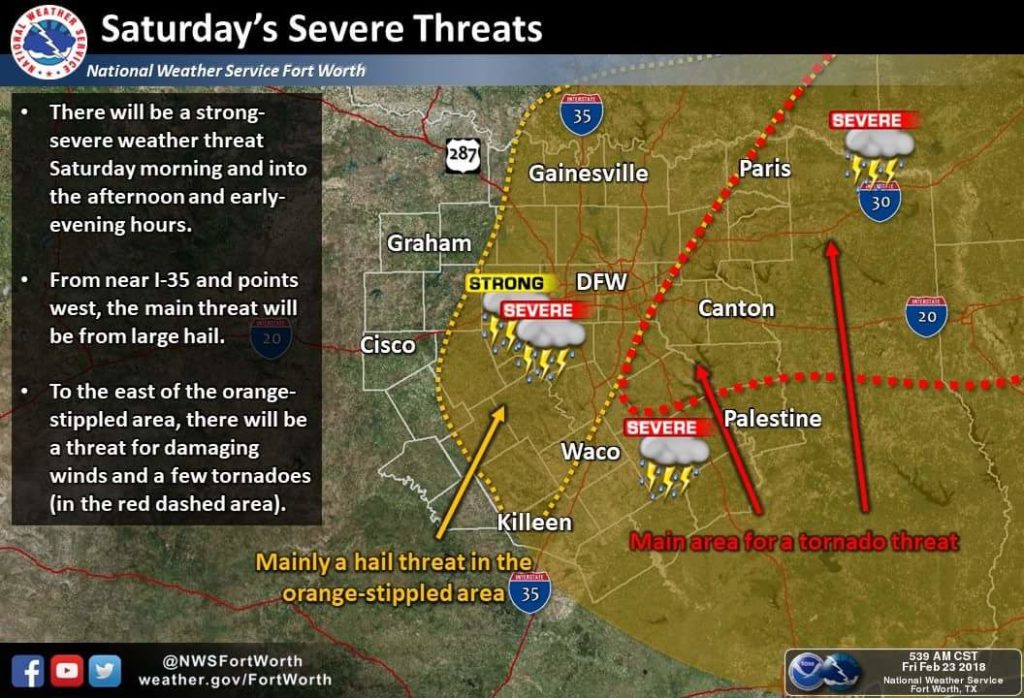
Saturday’s forecast calls for more thunderstorms with the possibility of severe storms capable of large hail and heavy rain.
The severe weather threat returns during the late morning and into the afternoon hours, generally for areas south of the I-30 and east of the I-35 corridor. Large hail, damaging winds, and a few tornadoes will be possible.
In addition, heavy rain will aggravate any ongoing flooding. All thunderstorms will exit the region to the southeast Saturday evening. Thunderstorm chances will return to all of North and Central Texas Tuesday through Wednesday night. A few strong storms will be possible.