myparistexas.com keeps you informed with the latest weather updates.
If the weather gets severe, click here for LIVE updates or tune in to KFYN 104.3FM The River.
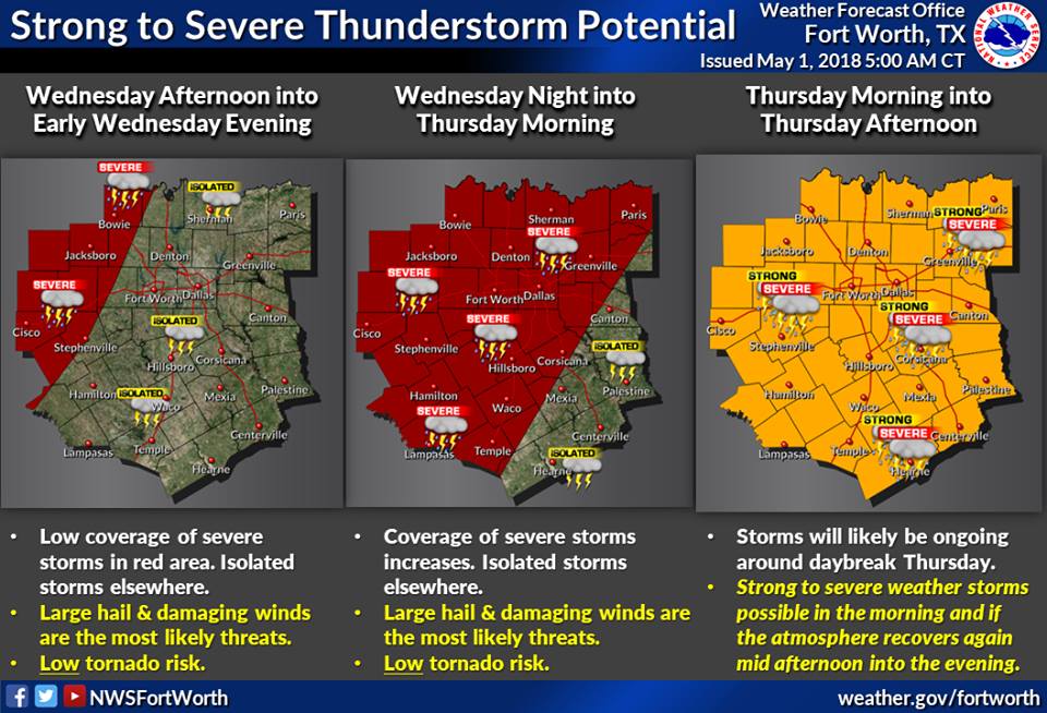
From the National Weather Service in Ft. Worth:
A strong cap should help keep thunderstorm chances low for much of the day on Wednesday, although isolated strong to severe storms could impact our northwestern counties late in the afternoon.
More widespread thunderstorms are expected to initiate along a dryline somewhere near a Wichita Falls to Big Spring line Wednesday evening, and these may eventually track towards the I-35 corridor by Thursday morning.
These storms could be severe, with mainly a large hail and damaging wind threat, but there will be a potential for a tornado or two with this activity.
If this area of storms clears out of the region by late-morning or early-afternoon on Thursday, then another round of strong to severe storms will be possible during the afternoon and into the evening hours, with a threat area covering most of North and Central Texas.