
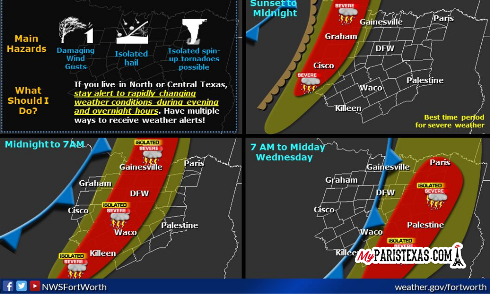
Thunderstorms are expected to move across the north and central portion of Texas later tonight, with the likelihood of severe weather, according to the National Weather Service.
The highest potential threat of storms is expected along and west of a line from Sherman, to Corsicana, to Waco and Temple, which “damaging winds will be the primary hazard. Large hail and a few tornadoes will be possible with any discrete storms that occur within or just ahead of the line.”
Severe weather threat will continue Wednesday morning along east of I-35 as a cold front the line of strong and severe storms continue to move into East Texas, toward Louisiana.
“Very windy conditions will occur behind the cold front late Wednesday and continue through the end of the week. Northwest winds 25 to 30 mph with gusts to near 40 mph at times will be possible and will cause dangerous crosswinds on regional highways and interstates. Open waters on area lakes will be very choppy as well.”
–
Like and follow MyParisTexas.com on Facebook, and share this story – Reporting local news in Paris and Lamar County, Texas.